T: 01822 851370 E: [email protected]
Visit RSN Survey about life in rural England to find out more.
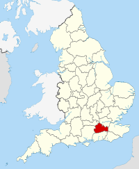
Surrey
|
Working for our part of Rural England with the Rural Services Network |
|
|
Location: South East Population: 1,168,809 (Mid-year estimate 2015) Interesting fact: In the third week of July each year, the River Thames witnesses the ancient ceremony of Swan Upping: the annual census of the swan population for the Queen. The ceremony has been going on since the 15th century and when Queen Elizabeth attended in 2009 it was the first time a monarch had been at the ceremony for over 350 years.
|
||||
| Surrey |
Surrey is a member of the Rural Services Network and falls |
||||
Surrey Information |
||
| Phone number 03456 009 009 |
Website http://new.surreycc.gov.uk/ |
Local Enterprise Partnerships (LEPs) Enterprise M3 |
| Frequency of elections Every 4 years |
Number of councillors 81 |
Political composition Conservative - 61 Liberal Democrats - 9 Residents' Associations/Independents - 9 Labour - 1 Green - 1 |
| MPs East Surrey - Sam Gyimah (Conservative) Epsom & Ewell - Chris Grayling (Conservative) Esher and Walton - Dominic Raab (Conservative) Guildford - Anne Milton (Conservative) Mole Valley - Sir Paul Beresford (Conservative) Reigate - Crispin Blunt (Conservative) Runnymede and Weybridge - Philip Hammond (Conservative) South West Surrey - Jeremy Hunt (Conservative) Spelthorne - Kwasi Kwarteng (Conservative) Surrey Heath - Michael Gove (Conservative) Woking - Jonathan Lord (Conservative) |
Decision making structure Leader and a Cabinet |
Population change Population change One Year Population Change + 0.7% Ten Year Population Change + 9.1% |
| Police Authority Surrey Police |
Fire Service Surrey Fire and Rescue Service |
Health Authority SASH Surrey and Sussex Healthcare NHS Trust |
| Area 166,277 Hectares |
Rural Output Areas 500 rural OAs from 3578 OAs in total |
Audited by Southern Region (Audit Commission) |
| Rural Classification (Defra) Predominantly Urban |
Population by Area- (Density) 7.03 people per hectare |
Number of Parishes 86 |
| Number of Parish Meetings 0 |
Number of Parish Councils 82 |
Number of Town Councils 4 |
| Average house price Elmbridge - £501,000 Epsom and Ewell - £424,308 Guildford - £379,475 Mole Valley - £440,000 Reigate and Banstead - £355,000 Runnymede - £350,000 Spelthorne - £325,000 Surrey Heath - £350,000 Tandridge - £381,375 Waverley - £400,000 Woking - £345,000 (Median price paid by local authority, year ending Q4-2015 - provided by UK HPI data published by Land Registry © Crown copyright 2016) |
Outsourced Services Information yet to be supplied |
Average age of population 40.2 (2011 Census data) |
| Main Towns Addlestone, Ashford, Banstead, Caterham, Cobham, Earlswood, Egham, Egham Hythe, Epsom, Esher, Ewell, Horley, Molesey, Oxted, Redhill, Shepperton, Sunbury-on-Thames, Walton-on-Thames, Weybridge, Whyteleafe, Woking |
Unemployment rate 0.4% (JSA claimants for August 2017) |
Current Council Tax (amount reported is the amount received by the Council - no other services are included) 2015/2016 Council Tax - £1,219.68 2016/2017 Council Tax - £1,243.89 2017/2018 Council Tax - £1,331.55 |
| Percentage of households socially rented from council or local authority 4.9% (2011 Census data) |
Percentage of population who have reported they are in very good health 52.4% (2011 Census data) |
Percentage of population which provides unpaid care 9.6% (2011 Census data) |
| Employment by Occupation Percentage of people aged 16 and over who are in Social Major Group 1-3 54.7% (ONS annual population survey - April 15-March 16) |
Average annual wage for full time employees
|
Percentage of those employed in full time employment 75.8% (2011 Census data) |
| Cars or vans owned per household (2011 Census data) No cars or vans - 13.1% 1 car or van - 40.4%% 2 cars or vans - 34.2% 3 cars or vans - 8.7% 4 or more cars and vans - 3.5% |
Local Newspapers Information yet to be supplied |
National Park/AONBs Surrey Hills (AONB), High Weald (AONB) |
2015 English Indices of Deprivation analysis tool
(Produced by Oxfordshire County Council) |
||

(All factual information on these pages is updated annually by the RSN)
(Information given via links will however be updated as new information becomes available)


